Search Results
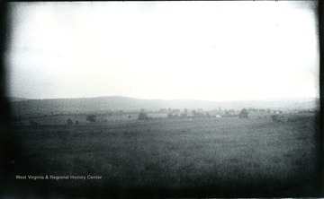
- IDNO:
- 031697
- Title:
- View from Dunker Church, Maryland
- Date:
- 1884/08/06
- Description:
- A view from Dunker Church looking eastward; the photo taken on Wednesday, 7:45 pm; 172.D.101.
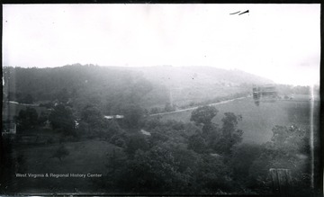
- IDNO:
- 031699
- Title:
- Tonoloway Creek, Maryland
- Date:
- 1884/08/09
- Description:
- A view of Tonoloway Creek before Hancock; the photo taken on Saturday at 9:10 am; 186.D.110.

- IDNO:
- 031700
- Title:
- View of Antietam From Pry House, Washington County, Maryland
- Date:
- 1884/08/06
- Description:
- A view of Antietam from Pry House, McClellan's headquarters; monuments in cemetery can be seen with magnifier on left horizon; the photo taken on Wednesday at 4:40 pm.

- IDNO:
- 031703
- Title:
- Eckert's Mine Valley, Maryland
- Date:
- 1884/08/13
- Description:
- A view of Eckert's Mine Valley from hill west; the photo taken on Wednesday at 10 am; 208.W.87.

- IDNO:
- 031706
- Title:
- View of Antietam, McClellan's Headquarters from National Cemetery, Maryland
- Date:
- 1884/08/05
- Description:
- A view of Antietam, McClellan's headquarters from National Cemetery, 2nd view from tower; the photo taken on Friday at 5:35 pm; D.88.I.C.152.
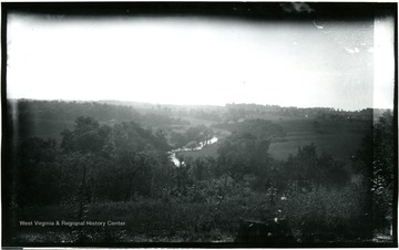
- IDNO:
- 031710
- Title:
- View of Antietam From Pry House, Washington County, Maryland
- Date:
- 1884/08/06
- Description:
- A view of Antietam Battlefield from Pry House (McClellan's headquarters) looking between East and West woods; the photograph taken on Wednesday at 4:48 pm; 97.D.I.C.166.

- IDNO:
- 031711
- Title:
- Antietam, Sinken Creek, Maryland
- Date:
- 1884/08/06
- Description:
- A view of Antietam, Sinken Creek from Benjamin Battery on Union side of Antietam Creek; the photo taken on Wednesday at 12:45 pm; 96.D.I.C.163.

- IDNO:
- 031714
- Title:
- Gilpintown Tannery, Maryland
- Date:
- 1884/08/11
- Description:
- A view of Gilpintown Tannery; the photo taken at 2:40 pm; 196.115.D.

- IDNO:
- 031719
- Title:
- View of Antietam, Dunker Church, Maryland
- Date:
- 1884/08/06
- Description:
- The view of Antietam, Dunker Church with East and West Woods from Benjamin Battery; the photo taken on Wednesday at 12:40 pm; 95.D.I.C.162.
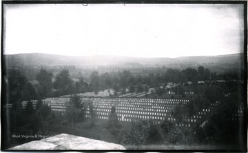
- IDNO:
- 031722
- Title:
- Antietam Cemetery, Maryland
- Date:
- 1884/08/07
- Description:
- A view of Antietam: South East from National Cemetery towards Burnside Bridge; the photo taken on Tuesday at 5:45 pm; 154.D.90.I.C.
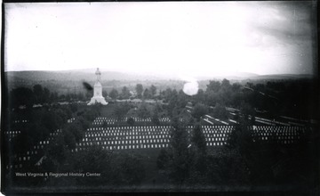
- IDNO:
- 031726
- Title:
- View of Antietam Soldier's Monument and Cemetery, Maryland
- Date:
- 1884/08/05
- Description:
- A view of Antietam, Soldiers' Monument taken from Tower of Cemetery, 5th view looking South; the photo taken on Tuesday at 5:50 pm; 155.91.D.I.C.

- IDNO:
- 031949
- Title:
- Youghioghenny River Six Miles Beyond Boundary Line into Pennsylvania
- Date:
- 1884/08/14


